
In the past decade drone use on construction sites has grown dramatically, delegates attending the recent Canadian Concrete Expo were told, employed for significantly broader applications than merely taking great video to mark a milestone.
Two veterans in the field, Ben Stocker, a senior construction technologist at Skender, and Adam Caldwell, lead VDC drone pilot with Maple Reinders, described how drones and reality capture technology are being used to greatly augment construction workflows, from site documentation and monitoring progress to thermal inspections and tracking utilities.
Their recent presentation at the expo in Toronto was titled Elevating Construction with Drones and Reality Capture.
Stocker said most larger companies are doing drone reality capture in-house, while smaller and mid-sized companies are still debating whether they have the resources to create their own division.
“We’re seeing more and more that projects are coming with a budget for drones,” said Caldwell.
“More and more people are trying to do it, because it’s relatively easy to do,” Stocker added. “I’m teaching product engineers and system product managers how to fly. It’s really easy.
“The hardest part is just knowing actually what to do with this data, capturing it and producing it.”
��
Right from the start
If drone footage and the associated tech applications are going to be part of a project, Stocker said, the drone specialist has to be engaged right from the beginning.
“When we’re starting a new project, we always make sure that we get a drone capture within one week,” he said.
Caldwell acknowledged the original use of drone footage, for public relations and engagement, is still an important element.
Firms need footage to produce branded content for business development and to increase awareness of the their operations.
“Most of the calls we get, ‘we need some drone shots for this milestone,’” said Caldwell. “We’ve extended that and produce content.”
Aerial data enhances decision-making, efficiency and collaboration across projects, Stocker and Caldwell said.
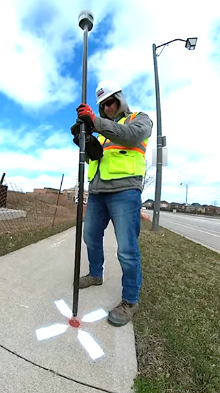
High-accuracy drone mapping is becoming an essential tool for unlocking site data, using Real-Time Kinematic, a satellite positioning technique that enables sub-inch positional accuracy, they said.
Aerial pano (panoramic) photography offers a 360-degree view of the site that is easily sharable and tracks changes over time – especially important when crews are working so quickly the site profile is constantly changing.
Crews can compare profiles over time, Caldwell said, tracking, for example, the progress of formwork.
“This helps with laydown, where all the equipment is, the site conditions and, of course, progress tracking,” he said.
Stocker recalls asking one pilot why there were so many captures over a short period.
“She told me, ‘oh…a lot was happening in one day. So I wanted to make sure that I captured it multiple times throughout the day, and it was a quick flight that took five or eight minutes,’” he recounted.
Caldwell said high-accuracy mapping is now the standard.
A drone flies an automated route over a site to capture aerial imagery for the project. Ground control points are surveyed and integrated into the drone software to increase mapping accuracy, he said.
“We know the precise location of that with the GPS unit,” he explained. “You bring those two together, you get an accurate representation of the real world in the co-ordinate system.”
Stacking overlays
Progress tracking is amplified as more technical overlays are added, Caldwell said. The high-quality map is integrated with design drawings in the trailer, then a utilities map can be added, and a foundation plan, for example.
“It can all be stacked together and quickly filtered through again with that map,” he said.
Stocker added, “Underground utility tracking, this is been huge for us.”
Leading-edge technology currently in use includes 3D Gaussian splatting, which is a real-time 3D reconstruction method that converts drone-captured photos into a highly detailed, photorealistic 3D site model.
Other tasks highlighted by the presenters included reality capture to record flatness and slope checks as work progresses onsite, material volume calculations and cut/fill progress.
One enthusiastic site supervisor described the benefits of volume calculations to Stocker: “In order to maintain schedule, I had to use the drone map to do a volumetric calculation to confirm the amount of flowable fill l needed instead of waiting for the concrete PM to come out and review the condition. This was a last-minute change and l had to get it completed to keep our slab on grade pour schedule.”


Recent Comments
comments for this post are closed